Evacuation warning issued for Creek Fire burn scar area in Fresno County
The burn scar area is at risk of mudslides, rockslides and debris flow as a powerful winter storm moves into the Central Valley.

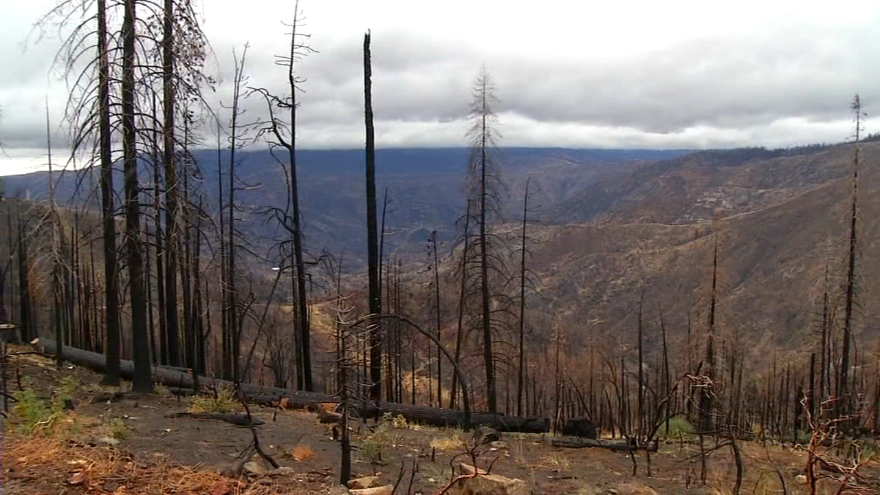
FRESNO, Calif. (KFSN) -- Fresno County authorities have issued an evacuation warning for a large portion of Fresno County that was devastated by the Creek Fire last year.
The Creek Fire burn scar area, which spans the Big Creek Canyon from below Big Creek to the San Joaquin River, is at risk of mudslides, rockslides and debris flow as a powerful winter storm moves into the Central Valley.
Personnel from the Fresno County Sheriff's Office, County of Fresno and the National Weather Service together decided to put the area under an evacuation warning so residents can be prepared to leave if conditions worsen for them.
An evacuation warning does not make it mandatory for residents to leave the area immediately. However, those who require more time to evacuate and those with pets or livestock should heed the warning and leave.
The strong storm is expected to bring with it heavy downpours in the San Joaquin Valley and snow in the Sierra Nevada.
RELATED: Tracking the atmospheric river: Here's when Central CA will see rain this weekend
Fresno County officials say this is the largest forecasted storm since the Creek Fire ripped through the area, scorching nearly 380,000 acres in 2020.
They say heavy rainfall could cause catastrophic damage.
So it's really important for people who live near these burn scars to know where they are in relation to the path of the water.
"The soil has been disturbed, a lot of the grasses and the brushes that normally help hold that soil in place have been burned, and some of that soil could be looser and we also anticipate the possibility of rocks falling so people should really look out for those low-lying areas, the streams and what's uphill of them," said Fresno County Sheriff's Office Lt. Kathy Curtis.
If you want to know if your neighborhood is under the warning, enter your address to see the threat level on this interactive map created by the Fresno County Sheriff's Office.
In the meantime, PG&E is anticipating widespread power outages and is urging people to keep their flashlights handy and their phones charged.