StormWarn 30 Radar
- Special Weather Statement
At 552 PM PDT, Doppler radar was tracking a strong thunderstorm near East Porterville, or 10 miles east of Porterville, moving southeast at 35 mph. HAZARD...Wind gusts up to 40 mph and pea size hail. SOURCE...Radar indicated. IMPACT...Gusty winds could knock down tree limbs and blow around unsecured objects. Minor hail damage to vegetation is possible. Locations impacted include... Quaking Aspen, Oak Opening, Camp Nelson, Ponderosa, Peppermint, Springville, Uhl, East Porterville, and Porterville.More
- Special Weather Statement
At 550 PM PDT, Doppler radar was tracking a strong thunderstorm 9 miles east of Shafter, or 12 miles north of Bakersfield, moving south at 30 mph. HAZARD...Wind gusts up to 40 mph and pea size hail. SOURCE...Radar indicated. IMPACT...Gusty winds could knock down tree limbs and blow around unsecured objects. Minor hail damage to vegetation is possible. Locations impacted include... Oildale, Edison, Weedpatch, Bakersfield, and Lamont.More
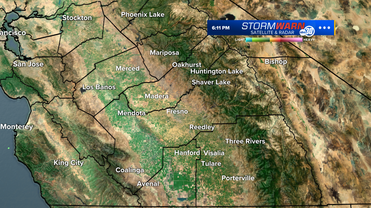
- Special Weather Statement
At 549 PM PDT, Doppler radar was tracking a strong thunderstorm 7 miles southeast of Merced, moving southeast at 20 mph. HAZARD...Wind gusts up to 40 mph and pea size hail. SOURCE...Radar indicated. IMPACT...Gusty winds could knock down tree limbs and blow around unsecured objects. Minor hail damage to vegetation is possible. Locations impacted include... Chowchilla, Le Grand, Planada, and Merced.More
- Wind Advisory
* WHAT...Southwest winds 20 to 30 mph with gusts up to 50 mph. * WHERE...Indian Wells Valley and Mojave Desert. * WHEN...Until 5 PM PDT Friday. * IMPACTS...Gusty winds will blow around unsecured objects. Tree limbs could be blown down and a few power outages may result.More
- High Wind Warning
* WHAT...West winds 30 to 40 mph with gusts up to 65 mph. * WHERE...Mojave Desert Slopes. * WHEN...Until 5 PM PDT Friday. * IMPACTS...Damaging winds will blow down trees and power lines. Widespread power outages are expected. Travel will be difficult, especially for high profile vehicles.More
- Winter Storm Warning
* WHAT...Heavy snow. Additional snow accumulations between 6 and 18 inches. Winds gusting as high as 60 mph. * WHERE...The Sierra Nevada, including Yosemite Valley. * WHEN...Until 11 PM PDT this evening. * IMPACTS...Travel could be very difficult. The hazardous conditions could impact the Thursday evening commute. Strong winds could cause tree damage.More
- Winter Weather Advisory
* WHAT...Snow expected. Total snow accumulations of 6 to 12 inches between 3000 and 4000 feet. Winds gusting as high as 40 mph. * WHERE...Fresno-Tulare Lower Sierra, Mariposa-Madera Lower Sierra, and South End of the Lower Sierra. * WHEN...Until 11 PM PDT this evening. * IMPACTS...Plan on slippery road conditions. The hazardous conditions could impact the Thursday evening commute.More
- Winter Weather Advisory
* WHAT...Snow. Total snow accumulations of 2 to 5 inches above 4000 feet and up to 15 inches at the highest elevations. Winds could gust as high as 55 mph. * WHERE...Frazier Mountain Communities, Grapevine, Piute Walker Basin, and Tehachapi. * WHEN...Until 5 AM PDT Friday. * IMPACTS...Travel could be very difficult. The hazardous conditions could impact the Thursday evening commute. Gusty winds could bring down tree branches.More