NWS Hanford confirms an EF0 tornado touched down near Huron


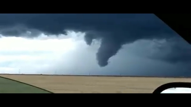
FRESNO, Calif. (KFSN) -- Hail in Huron, heavy wind and rain in Reedley and menacing funnel clouds in Kings County.
"It's something definitely out of the ordinary," Kris Mattarochia is the science and operations officer with the National Weather Service in Hanford.
He says a line of storms moved south along Interstate 5 on Sunday, eventually merging with another storm north of Avenal, west of Stratford.
RELATED: Wild weather moves across the Valley
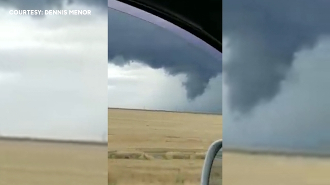
"It was when that storm merger took place that something happened as far as the strength of the storm, it became stronger," Mattarochia said. "And it also became more conducive with the changing wind direction and speed at low levels, to produce the funnel cloud photos that we saw."
On Monday, the National Weather Service sent a survey team to the Huron area.
Based on what they saw and the radar signatures, they determined an EF0 tornado with 70 mile per hour winds touched down for a brief period of time on Sunday.
RELATED: Winter-like storms have summer businesses watching the skies for upcoming Memorial Day Weekend
While an EF0 is technically considered weak, Mattarochia says all tornadoes are dangerous.
He says there have been far more than usual, this is the sixth of the season. And more severe weather is on its way this week.
"The weather's going to stay active and there could be thunderstorms with these systems," he said. "I'm not ready to say right now they could be as strong as yesterday. But it's not out of the question we could have thunderstorms that contain hail."