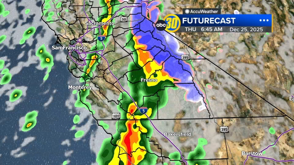
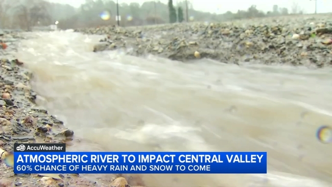
Atmospheric river to impact the Central Valley


FRESNO, Calif. (KFSN) -- Our Action News weather team and other local meteorologists are tracking an atmospheric river that is expected to reach Central California by the end of the month.
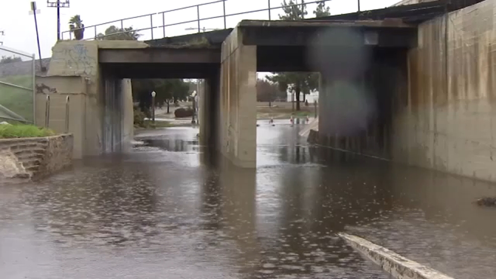
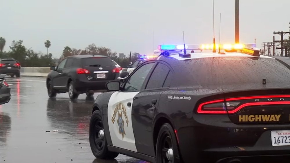
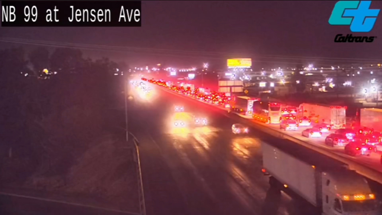
With last year's intense atmospheric rivers bringing flooded roads and damage to different parts of Central California, it's causing some concern for the next round of rain.
"You know we're still in recovery for those two incidents, and probably will be for a couple of more years," said Terri Mejorado, an emergency manager with the Fresno County Office of Emergency Services.
"We're still actively out at some of those sites that experienced some of the more severe damage, so one of the things that we can be very proactive about for the county, and preparation for the next emergency is really keeping track of what the county looks like today."
This next storm system has a high risk of bringing hazardous rain to the Valley.
Compared to last year's historic rain season, this year has been off to a slow start, but the National Weather Service is warning of an atmospheric river bringing high risk of hazardous rainfall.
"Right now, the weather prediction center has put the San Joaquin Valley at a 60% chance, which is a high risk of heavy rain," said JP Kalb, Meteorologist with the National Weather Service.
The timing of the atmospheric river is expected to start impacting the West Coast on January 31st, bringing 60-80% of above-normal precipitation chances through February 6th for inland areas.
Although it is still early to determine how strong the atmospheric river will be, rain this past Monday set records in Merced and Madera, with Merced getting just over 2 inches of moisture, not including today's rainfall.
"We are looking at a 30-55% chance of at least half an inch of rain from Wednesday morning to Thursday morning of next week," explained Kalb.
High winds are also expected to impact inland areas, and if rainfall probabilities hold, excessive rain in the Sierra Nevada and foothills could lead to flooding and mudslides.
"About a 5% chance right now of flooding at Pohono Bridge onto Merced River," said Kalb.
Mejorado says they are also preparing for the storm with new tools to track flooding.
"The lessons that we've learned we are incorporating operating them in just our day-to-day operations, public works established cameras and sensors on some of the bridges and waterways throughout the county," said Mejorado.
And a friendly reminder: in a situation where you have to evacuate, have a kit ready to go suitable for everyone.
"One big thing I might emphasize, especially towards the families of autistic individuals and more diverse individuals, is to have comfort items," said Kalb.
Comfort items can be essential for people who have been displaced from their homes.
Again, the timing of this next big storm is expected to impact the Valley starting a week from Wednesday.
For news updates, follow Nico Payne on Facebook, Twitter and Instagram.
For news updates, follow Brianna Willis on Facebook, Twitter and Instagram.